Dr Robin Wilson
Freelancer in Remote Sensing, GIS, Data Science and Python
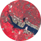
Remote Sensing/GIS
I am experienced at processing large volumes of raster and vector data to generate useful insights.
I have a PhD in atmospheric remote sensing, and am an expert in atmospheric radiative transfer modelling.
I have built cloud-native geospatial systems for processing hundreds of TBs of imagery.
Data Science
I have led data science teams producing data at the highest level - including data used by the United Nations.
I can provide value from your data, through analyses ranging from simple statistics to advanced machine learning models.
I am experienced in a wide range of data visualisation techniques
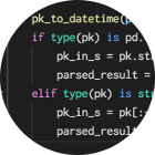
Python
I am an expert Python programmer, and am particularly experienced with the scientific Python stack, including numpy, pandas, matplotlib and scikit-learn.
I maintain multiple open-source Python modules, including Py6S, and have contributed widely to packages in the Python data science and geospatial ecosystems